
GPR Insights 3
- Multichannel GPR:
Compatible with any multichannel system. - Big data analytics:
Save time with our new ultra-fast computing architecture. - Unlimited project size and storage:
Don't limit yourself to few Gb and go beyond TB (capital B!)
Intelligent post-processing
Screening Eagle´s GPR data analytics and visualization software delivers superior quality of data post-processing thanks to the long-established GPR Slice algorithms and intuitive web-based software. In 2021, GPR Slice joined the Screening Eagle ecosystem and provides comprehensive data analytics software to handle very complex data sets. For users who are entering the world of advanced GPR data post-processing, or those who want to reduce their workflow by up to 80%, GPR Insights has established a new standard in the industry. You can use GPR Insights from anywhere, on any device and independently of your operating system. The only thing you need is a web browser.
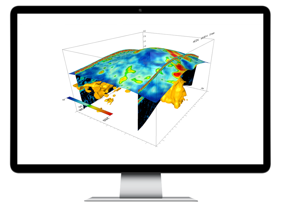
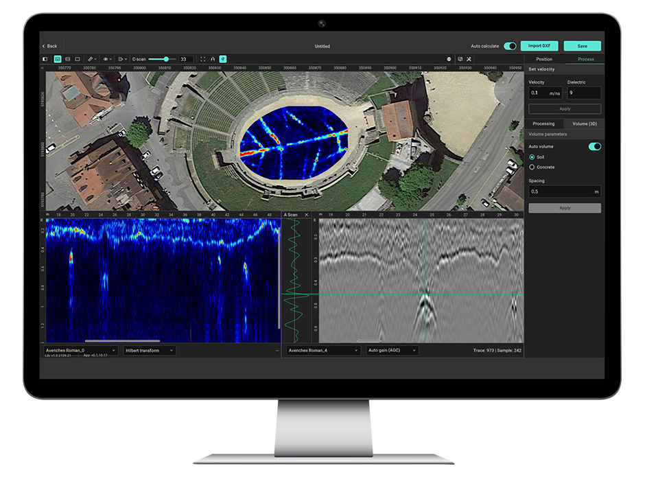
Empowering GPR Service Providers, Engineers and Geoscientists to post-process data faster than ever


GPR Insights
GPR Insights is an intelligent data analysis web-based solution for GPR Service companies, Subsurface Utility Engineers, and Geoscientists to increase productivity, profit, and scalability with an intuitive, platform-agnostic software for advanced analysis of any GPR data. See how GPR Insights can raise the quality of your deliverables with better and faster results for your clients.


GPR Slice
GPR Slice is the most reputable software for GPR imaging, with long-established and powerful algorithms. Since 1994, GPR Slice has been delivering the most comprehensive scope of imaging functionalities to create 2D/3D subsurface images for use in a variety of geotechnical, engineering and archaeological applications.


Integrate with GPS
The data export capabilities allow you to use the collected data in different software environments such as AutoCAD, directly in the design process. It also allows complete integration with GPS navigation, including GPR/GPS volume imaging and time slices (also random GPR track, the yaw, tilt and pitch of the antenna) for the best positioning and orientation of the collected data. This delivers seamless integration and interpolation across all GPR/GPS tracks.
GPR-Slice is a powerful software solution, compatible with all single and multi-channel GPR systems. It also allows complete integration with GPS/TS navigation (even accounting for yaw, pitch and roll of the antenna). Subscribe to GPR-Slice to get all the advanced functionalities for your GPR data on a variety of applications.

The Perfect Pack
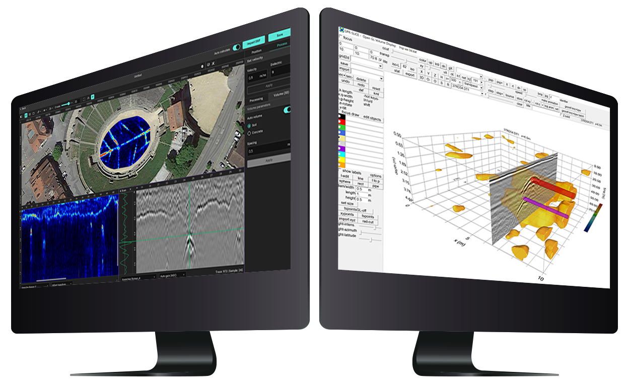
GPR Insights is the only software for GPR data analysis that, being fully web-based, platform independent and device agnostic, skips the complexity while maintaining advanced functionalities. Its workflows are optimized for non-experts and experts alike guaranteeing the highest quality.
On the other hand, GPR Slice remains the most complete solution in terms of number of functionalities, being the most renowned solution for academia, researchers and GPR experts needing very advanced analytic tools.
"With GPR Insights, the quality of data we can collect and the analytics are unmatched – our customers love the results.”
Rodrigo Jaque, Managing Partner at Geo Radar Chile

No, you don´t! You only need an internet connection on any standard laptop or PC.
Yes it does. On the first release, you can import .dzt, .dt and SEGY. We will be adding more propietary formats.
Almost none! We built an intuitive workflow so that users can focus on data analysis rather than reading manuals.
Yes you can. From Workspace, just search for the data set you want to analyze in Insights and start visualizing B-scans, C-scans and 3D views in no time.


